Working to preserve Ottawa's past
for future generations.
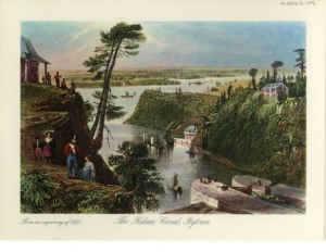
Ruth Hall-McMillan - The Rideau Canal Before 1900
This series of paintings was undertaken by Ruth Hall-McMillan in 1976 to commemorate the 150th anniversary of the start of construction of on the Rideau Canal by Colonel John By in 1826. The paintings depict scenes along the canal from Ottawa to Kingston during the years 1850 to 1895.
Ruth Hall-McMillan, a lifetime member of the Historical Society of Ottawa, was a local artist and writer whose work bridged the gap between fine art and historical preservation. She passed away in 2025 at the age of 93.
The Ruthven (Ruth) F. McMillan Rideau Canal Series, gifted by her family in honor of their mother, Ruth, and her father, R.H. “Bill” Hall, former Curator of the Bytown Museum.
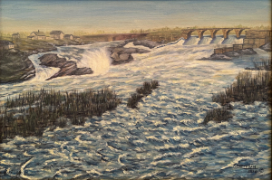
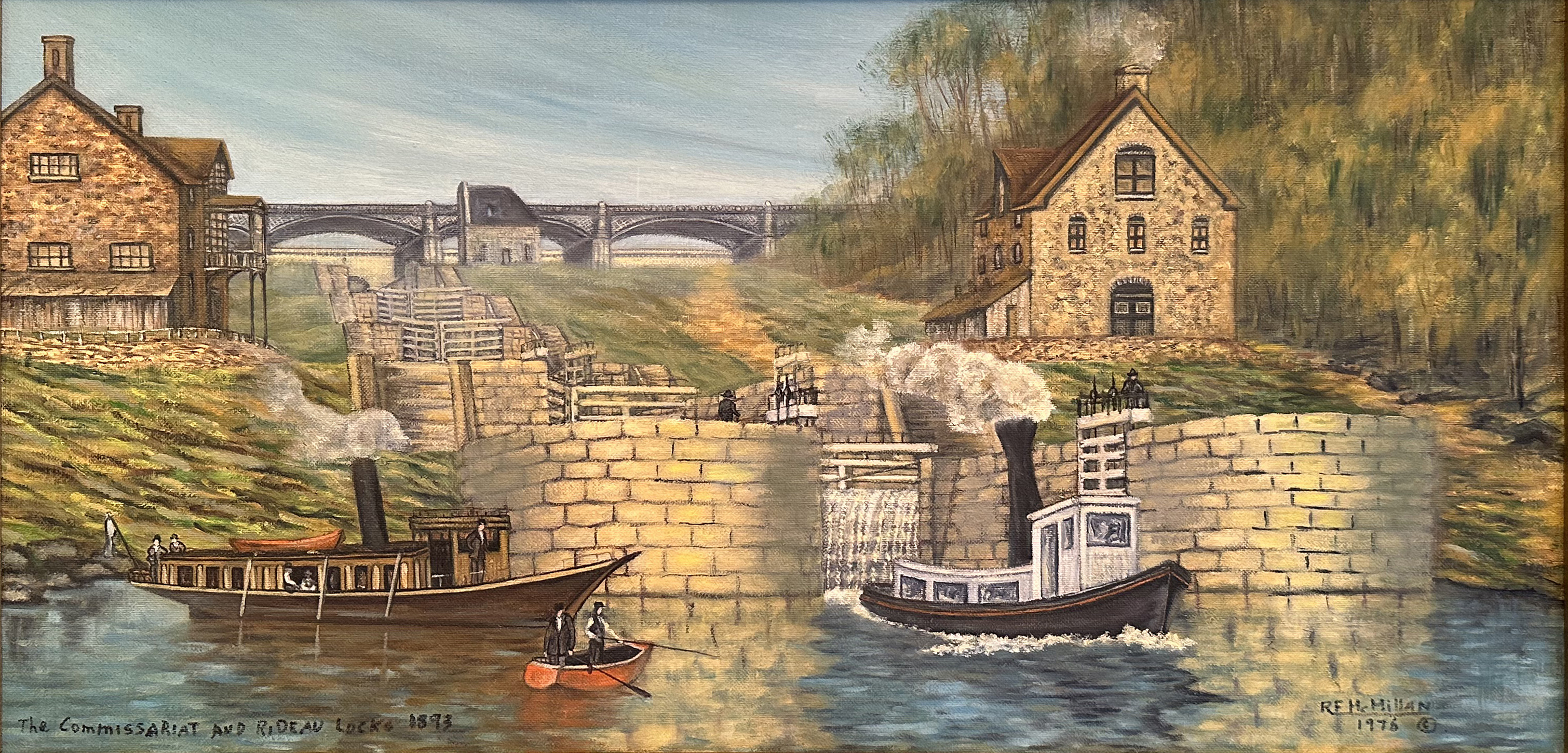 RF McMillan Rideau Lock
 RF McMillan Hogsback
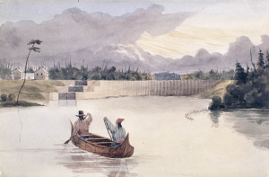
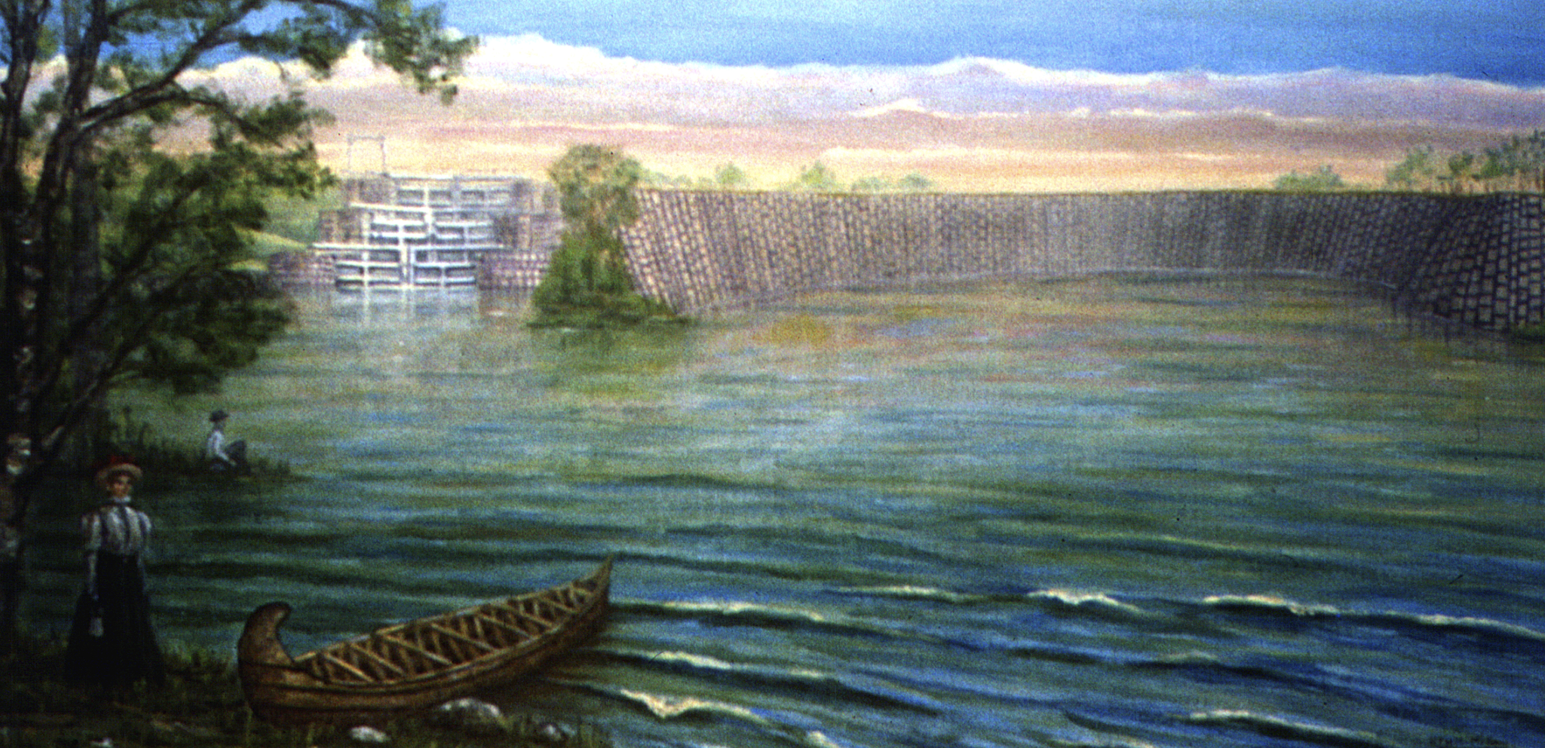 RF McMillan Long Island
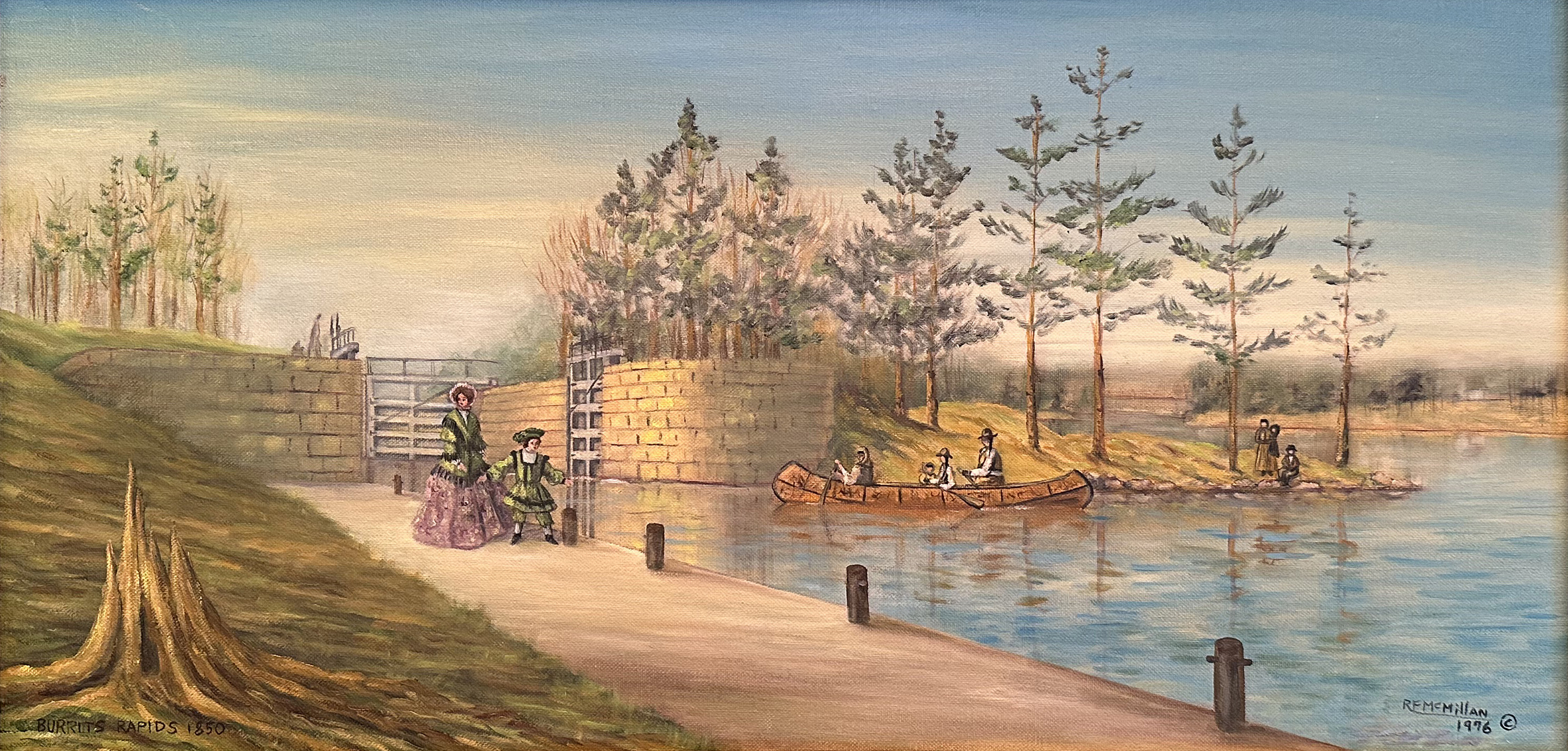 RF McMillan Burrit's Rapids
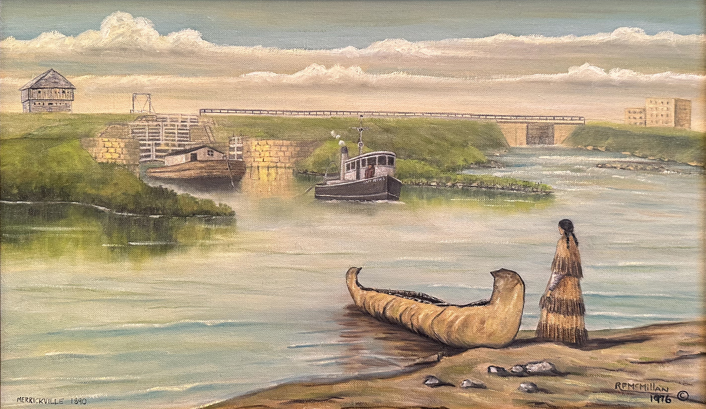 RF McMillan Merrickville
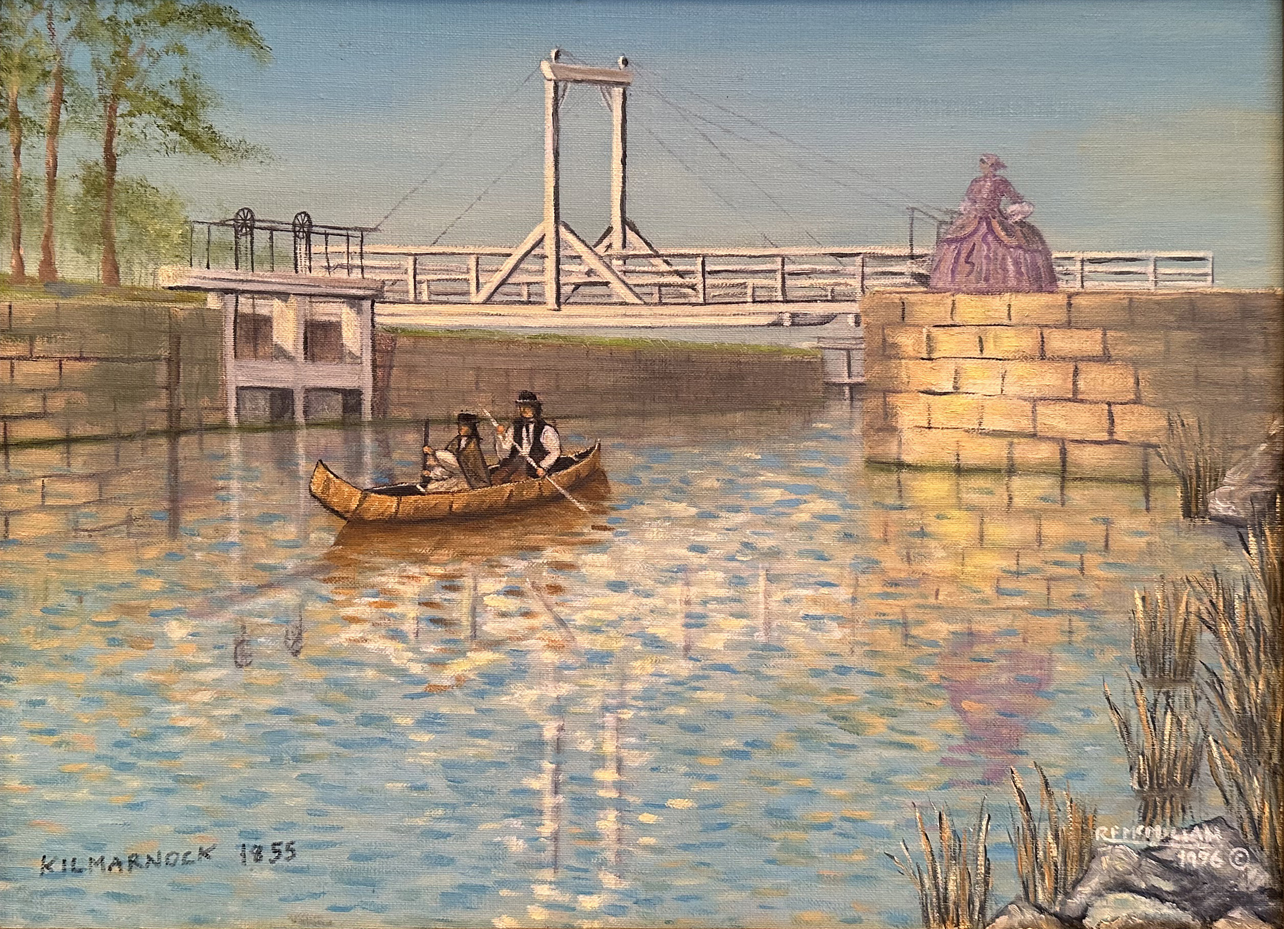 RF McMillan Kilmarnock
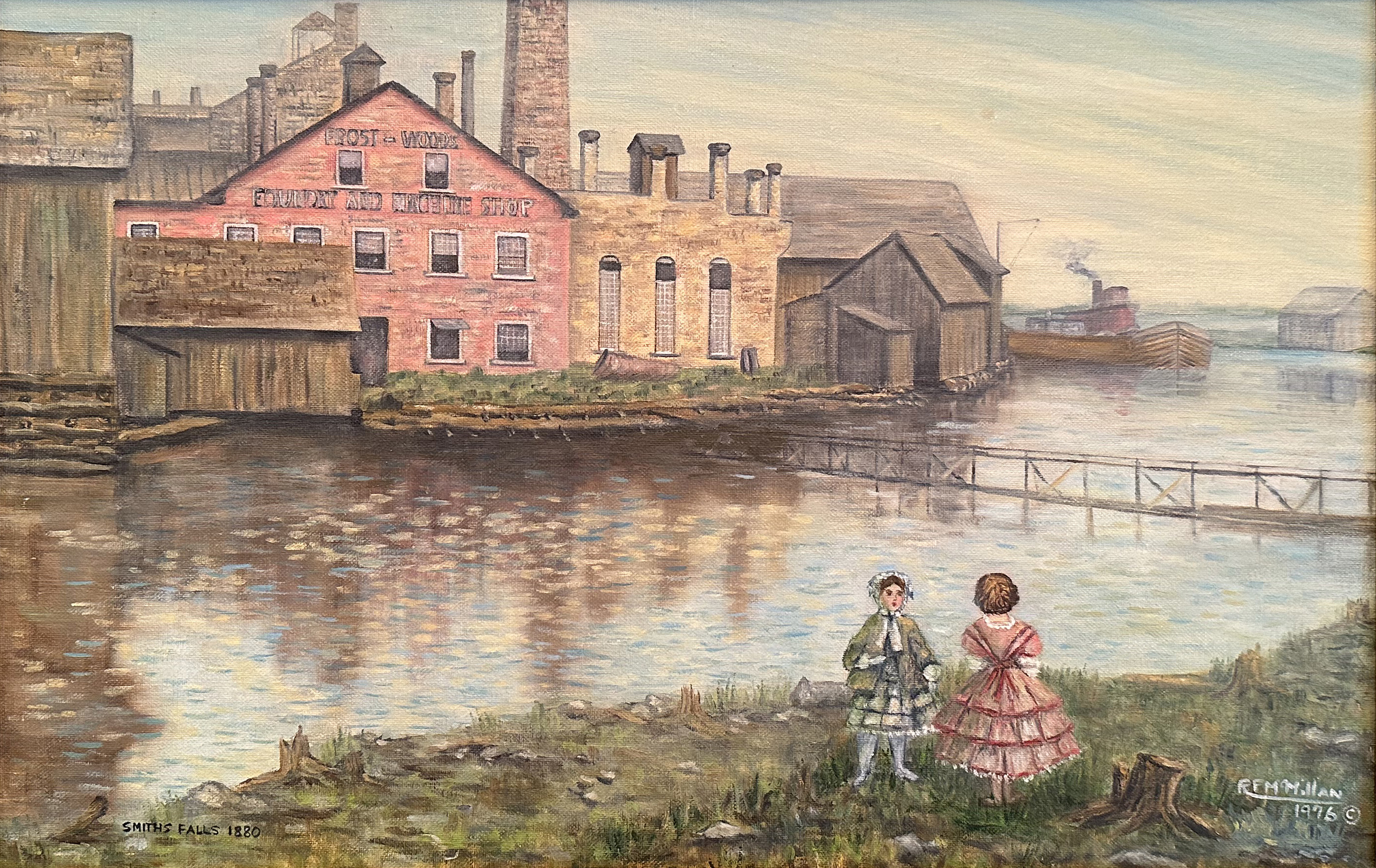 RF McMillan Smith Falls
 RF McMillan Beveridge
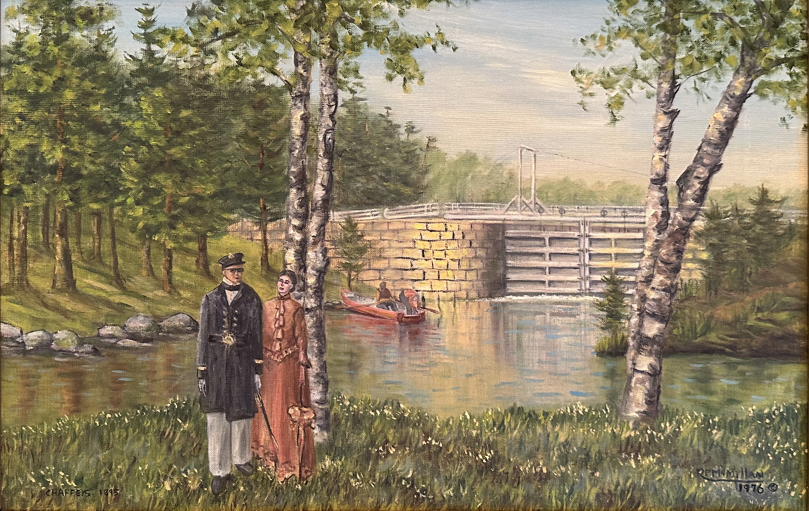 RF McMillan Chaffey's
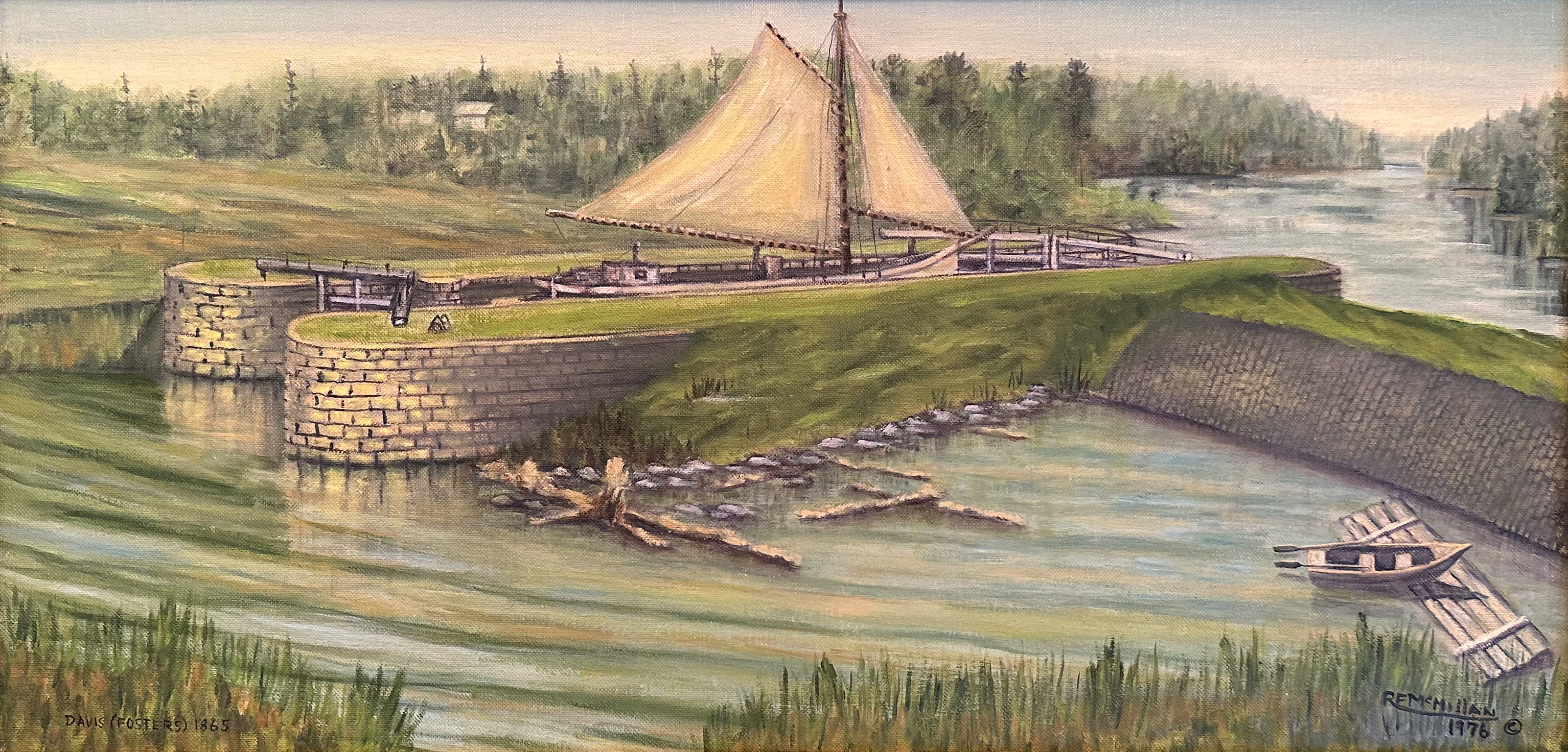 RF McMillan Davis
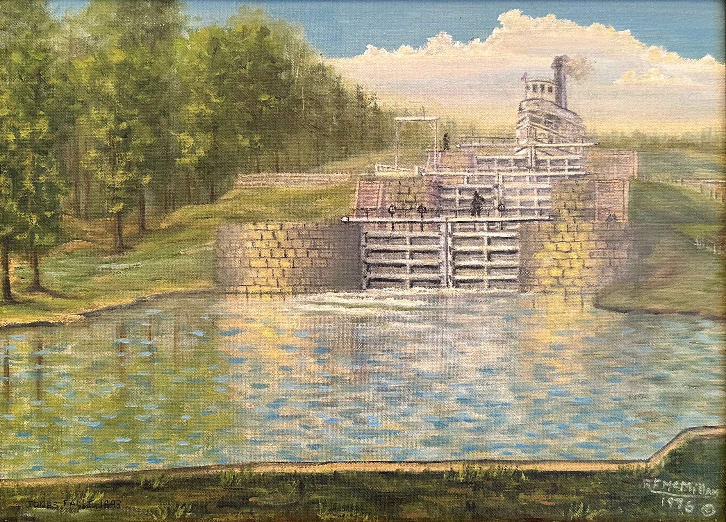 RF McMillan Jones Falls
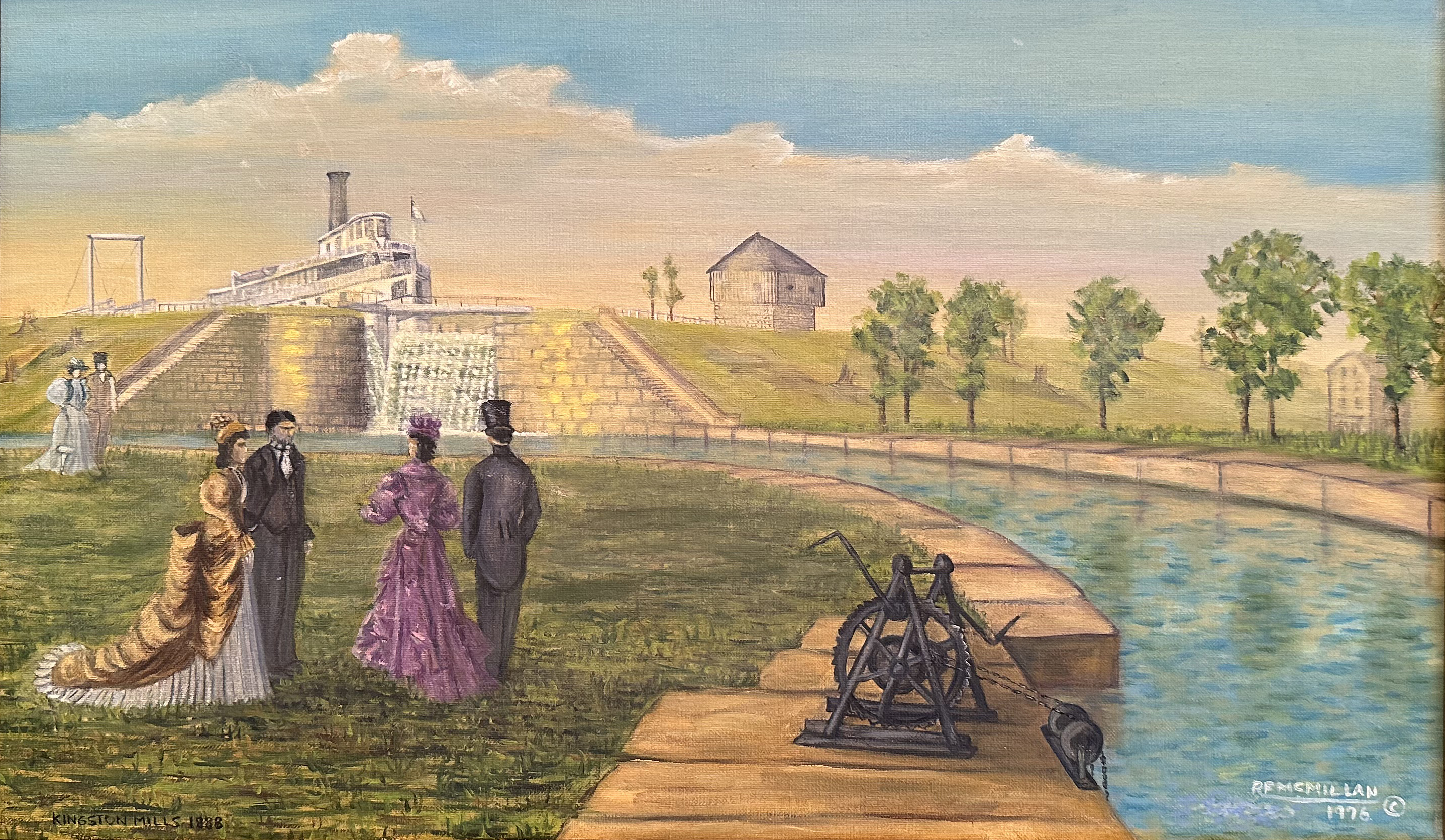 RF McMillan Kingston Mills
The HSO 2026 Bytown200 Bicentennial Storytelling Challenge
Let’s hear your stories about Bytown and the Rideau Canal as we begin to mark 2026, the 200th anniversary of the beginning of both!
All contributions are welcome. Selected submissions will be shared on a special webpage on the HSO website for all to access, including educators. Eligible contributions can be submitted in a variety of formats, including written or audio/video.
We hope to also incorporate selected contributions into our many other platforms – such as our blog, the HSO Capital Chronicle newsletter, website articles and the Ottawa Stories sections and potentially our pamphlet series. All will be shared through our social media platforms well.
We welcome stories that pertain to the Rideau Canal or Bytown (1826-1855) or the Ottawa area’s history beforehand, as well as stories exploring the impact that the establishment of both had on the lives and livelihoods of Indigenous people.
We welcome new as well as updated or previously-published materials for submission. Contributors will allow HSO the right to publish their materials while also retaining the right to do so themselves.
Contact us to learn more: This email address is being protected from spambots. You need JavaScript enabled to view it.
We will also be happy to discuss any proposals for submissions you may have.
Have a look at our collection of stories: www.historicalsocietyottawa.ca/resources/bytown-200
Andrew King – The Vanished Village of Long Island
First settled in the early 1830s during the construction of the Rideau Canal, the bustling village of Long Island would, by the mid-1800s, boast multiple streets, churches, general stores and hotels — and its own post office.
Once located near today’s Long Island Locks, Andrew King was perplexed to find nothing now remaining but grassy empty fields and the crumbling ruin of an old farmhouse, and no surviving signs of the once thriving community.
Curious as to how all traces of this “ghost village” north of present-day Manotick could simply disappear, Andrew proceeded to try to track down clues of “The Vanished Village of Long Island”:
ottawarewind.com/2017/11/19/the-vanished-village-of-long-island/
Andrew King is an Ottawa artist and historian and author of the Ottawa Rewind blog.
Alastair Sweeny – Lord Dalhousie and the Rideau Canal
There was perhaps no greater proponent for construction of the Rideau Canal than Lord Dalhousie, Governor-in-Chief of British North America.
As part of the HSO 2026 Bytown200 Bicentennial Storytelling Challenge, Alastair Sweeny recounts the contributions of Lord (and Lady) Dalhousie to the establishment of the Rideau Canal and Bytown.
Alastair Sweeny, PhD is the author of several books on Canadian history and technology, including George-Étienne Cartier: A Biography, BlackBerry Planet, and Fire Along the Frontier: Great Battles of the War of 1812 and Thomas Mackay: The Laird of Rideau Hall and the Founding of Ottawa.
Dr. Sweeny is based in Ottawa and is a member of the Historical Society of Ottawa.
Read the essay here: Lord Dalhousie
Allison Margot Smith – New Film for the HSO on the Rideau Canal
Produced especially for the “HSO 2026 Bytown200 Bicentennial Storytelling Challenge” this new film “Two Wars, Three Watersheds, A Slew of Surveys & A Canal”, by historian and documentary filmmaker Allison Margot Smith, traces the extensive surveys and planning, in response to the threat of American attack, that ultimately led to the construction of the historic Rideau Canal:
Follow this link to learn more about the film maker and to view some of Allison Margot Smith's previous films on the Rideau Canal:
Join us for our March 28, 2026 Speaker Series presentation when Allison discusses the history of the Rideau Canal, including a screening of her new film:
https://www.historicalsocietyottawa.ca/activities/events/eventdetail/184/-/the-rideau-canal
The Origins of the Rideau Canal
On Saturday March 28, 2026, Allison Margot Smith gave a film-screening of her recent film “Two Wars, Three Watersheds, a Slew of Surveys and a Canal.” The film describes the history of the Rideau Canal, and in particular, the planning of the route of the canal, starting in the 1780s.
The reasons for building the canal changed over time, as did ideas for the route. So, it took more than fifty years to arrive at a plan for the canal. Even the geography of the land mass to be transited by the canal changed due to human activity in this relatively wild country. But by 1826, 200 years ago, a route had been chosen and budget had been allocated by British Parliament. Lieutenant-Colonel John By was sent to start work on this mammoth project, and his encampment – called Bytown – was established, launching what is now our city.
Following her film, Allison gave a short talk on the imagery used to create her film, including the challenges of sourcing archival imagery for historical documentary films. She discussed how archival imagery and archival film footage can, in some cases, act as a kind of citation, offering proof that the assertions in a film reflect the realities of the past. This is important in a historical documentary film, since films, unlike academic papers, don't have traditional citations. And while archival images may be imperfect citations, even traditional citations may not be perfect proof of an assertion.
Allison also talked about questions, raised recently, about the potential inability to trust documentary films, with the emergence of Artificial Intelligence and AI-generated films. Her talk addressed the intent and legitimacy of AI in film-making, and she suggested that these new technologies may not be so different from traditional photography or historical art composition, depending on the intent. Finally, she touched on the use of archival cartoons as a way of illustrating and providing a "citation" for historical social commentary.
The City of Ottawa Archives – Bytown 200th: Ottawa's history
The City of Ottawa Archives joins in marking 200 years since the founding of Bytown, by presenting a serialized look at the community’s early development.
“Bytown: Construction Camp to Fledgling City” explores the transformation of a frontier settlement into a vibrant urban centre. Through archival records, historical insights, and profiles of key figures, follow this series as the Archives brings Bytown’s story to life—one chapter at a time: https://ottawa.ca/en/node/3042265
The City of Ottawa Archives are the custodians of permanent and historical civic government records on behalf of the City of Ottawa and its many departments, as well as local, community records with historical value. They preserve, acquire and make these documents accessible for City staff, the public, and other researchers, for present and future generations.
Jack Hanna – Centretown BUZZ Ottawa 200 series
To mark Ottawa’s 200th anniversary, the Centretown BUZZ community newspaper has commissioned Jack Hanna to pen an eight-part series reflecting back on the history of our city.
Jack Hanna is a retired teacher and journalist, amateur historian, and heritage chair of the Centretown Community Association.
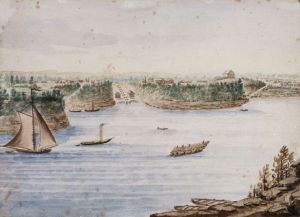
, painted circa. 1870. (Library and Archives Canada, W.H. Coverdale Collection of Canadiana).jpg) “Lake Allumette on the Ottawa River in Ontario”, by Alfred Holdstock (1820 1901), painted circa. 1870. (Library and Archives Canada, W.H. Coverdale Collection of Canadiana)
“Lake Allumette on the Ottawa River in Ontario”, by Alfred Holdstock (1820 1901), painted circa. 1870. (Library and Archives Canada, W.H. Coverdale Collection of Canadiana)
As a (non-Indigenous) Centretown resident, Jack Hanna reflects on the devastation caused to the Algonquin Anishinaabe people following the establishment of Bytown.
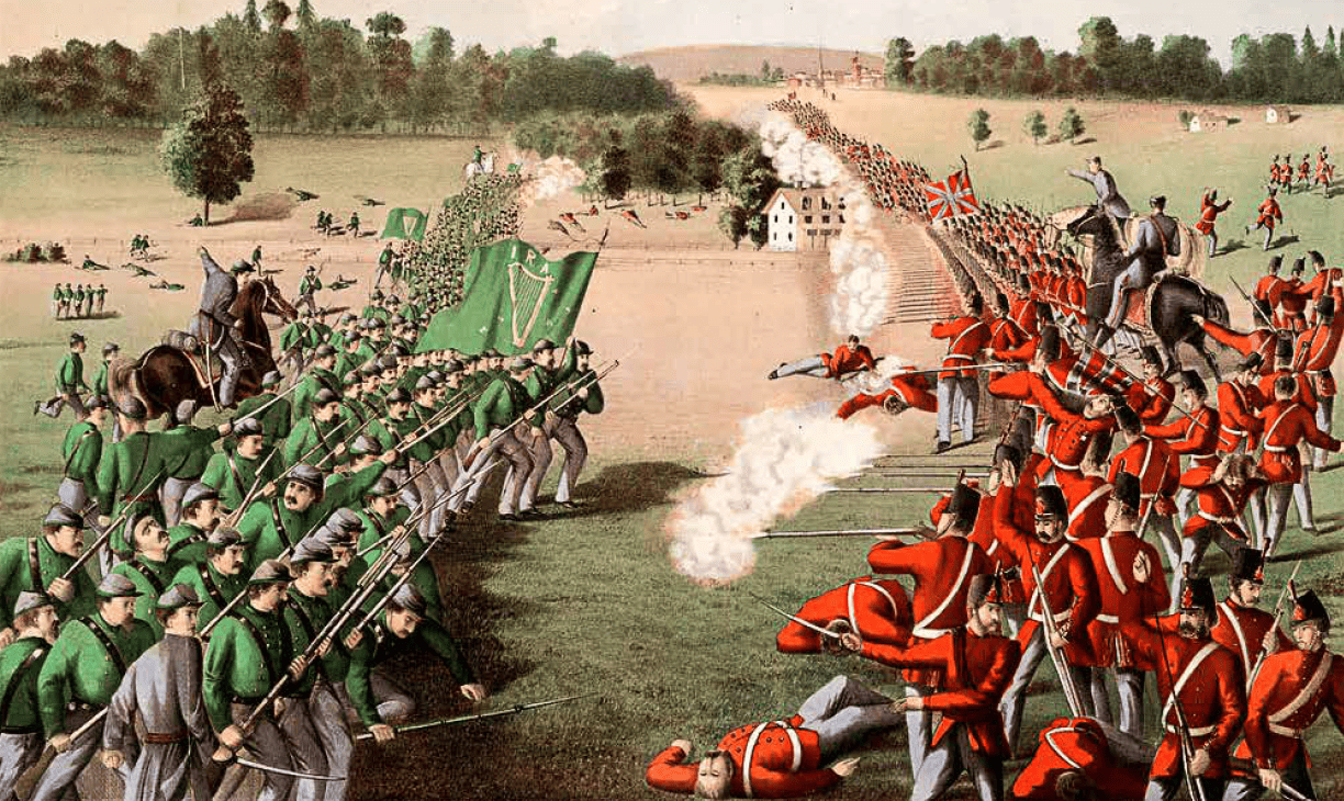 The charge of the Fenians at the Battle of Ridgeway, near Niagara, Canada West, on June 2, 1866. LAC.
Jack continues his look at local history by examining the threat posed by Americans over the years.
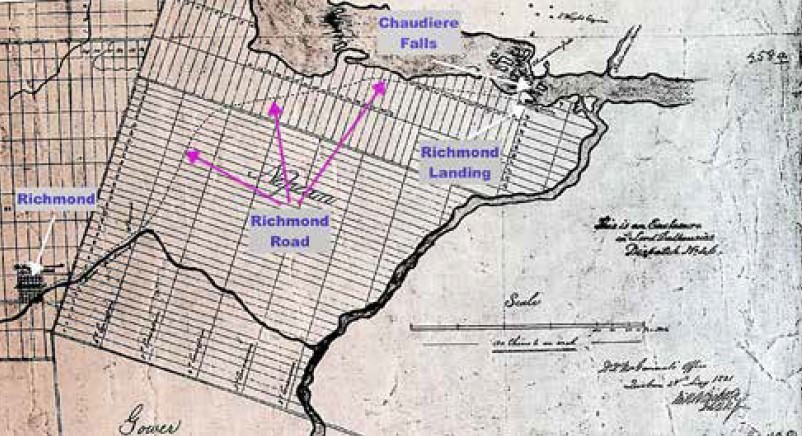 A contemporary map showing Richmond Landing and Richmond Road.
Jack Hanna shares the story of the Earl of Dalhousie, Captain LeBreton, and the shaping of the Rideau Canal:
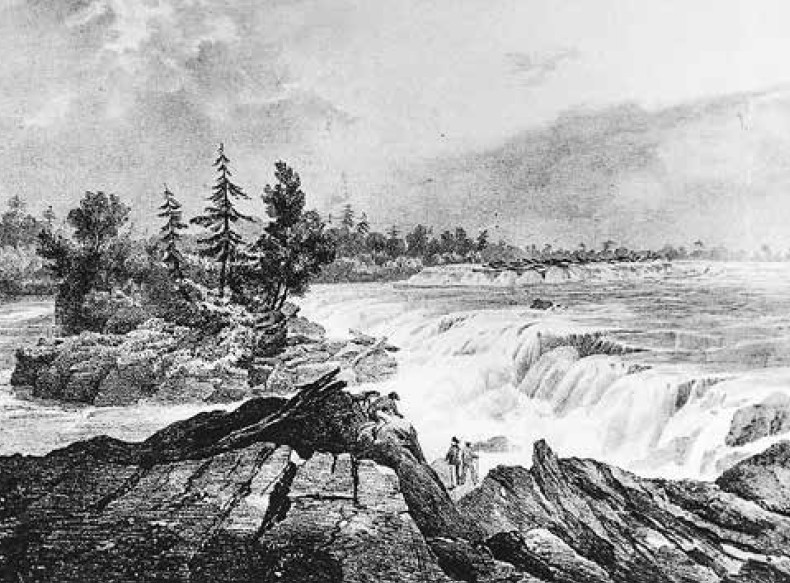 A drawing by Col. John By in 1826 of the Chaudiere Falls. (National Gallery of Canada).
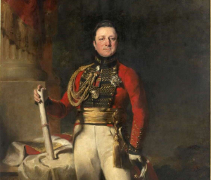
Jack Hanna paints an intimate portrait of the legendary overseer of the Rideau Canal’s construction, Lt. Colonel John By.
David C. Martin – What a Surveyor Saw: John Burrows and the Rideau Canal
What can we learn from the long-ago diaries of Rideau Canal surveyor John Burrows about how he perceived the landscape unfolding around him, through the lens of the British military, engineering, and colonial culture of the time?
Adapted from his recent lecture “Engineering Identity: John Burrows, Rideau Canal Landscapes, and Anglo-Canadian Ways of Seeing”, historian/researcher/writer David C. Martin looks beyond the many landscape paintings Burrows left behind, and instead explores what Burrows further revealed when he put pen to paper.
Read his account: Engineering Identity: John Burrows, Rideau Canal Landscapes, and Anglo-Canadian Ways of Seeing
Marking Bytown's 200 Anniversary

Many thanks to CTV Ottawa and CFRA iHeart radio for highlighting our bicentennial celebrations planned for 2026.
Watch HSO spokesperson Ben Weiss on CTV Ottawa Morning discuss the Historical Society's bicentennial plans. And stay tuned to the end of the clip to see a 100-year old relic from the centennial celebrations in 1926 to compare civic festivities of yesteryear! Link to Ottawa turns 200 this year video.
Check out our Bytown 200 story collection: www.historicalsocietyottawa.ca/resources/bytown-200
Quick Links
About
Supporting Partners